Top

Dolomites World Heritage Geotrail II

Karersee, Deutschnofen, Obereggen, Welschnofen
Add to favourites
Difficulty
Intermediate
Activity time
54:00
Duration in hours
Distance
198.2
Distance in km
Status
closed
Suggested period
Jan
Feb
Mar
Apr
May
Jun
Jul
Aug
Sep
Oct
Nov
Dec

Dolomites World Heritage Geotrail II – from the Bletterbach to the Sexten Dolomites

A long-distance hiking trail through the fossilized marine landscape of the World Natural Heritage

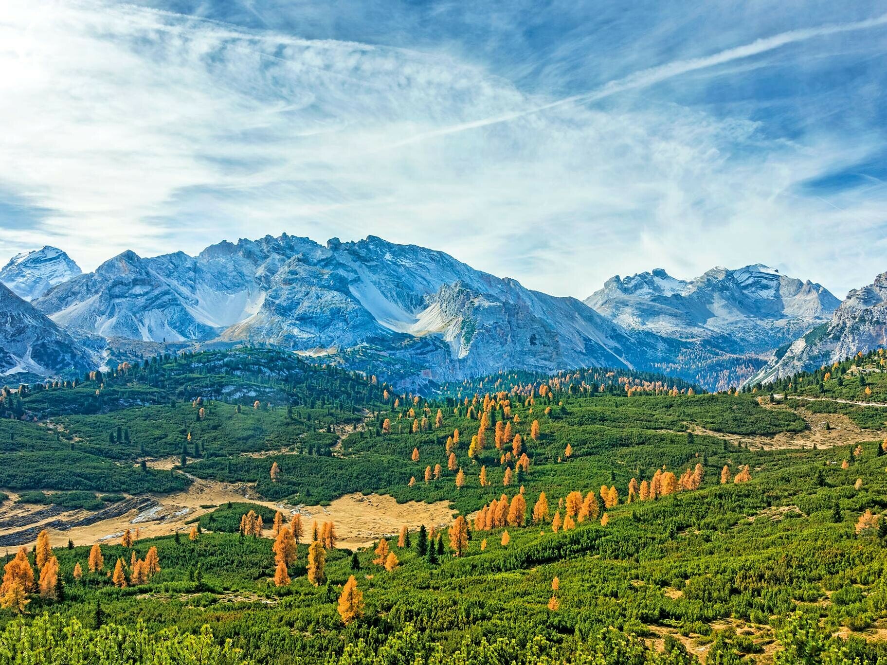
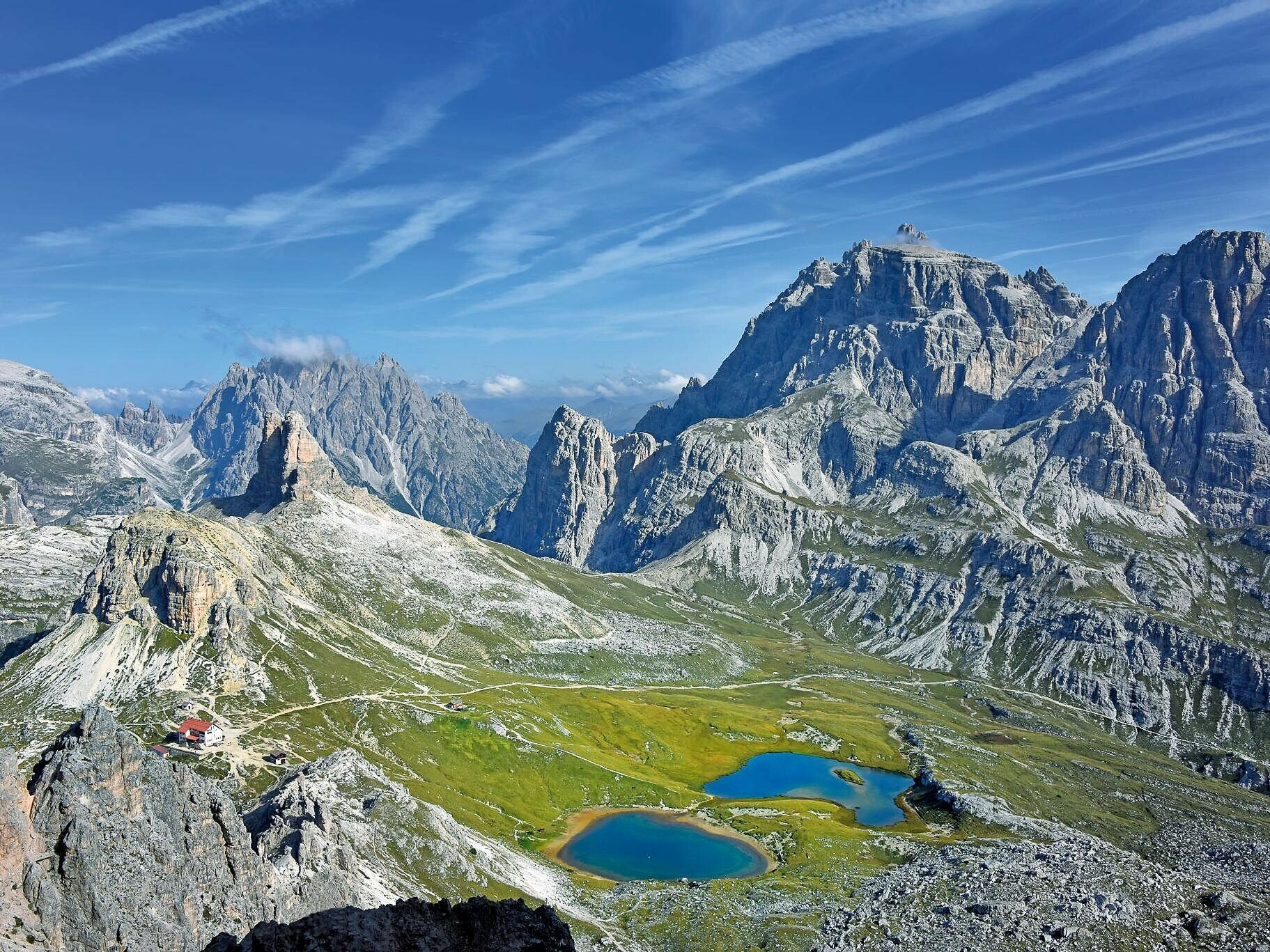
In 2009, the Dolomites were added to the UNESCO World Heritage list due to their extraordinary landscape and geological value. From this arose the idea to design a trekking route through the Dolomites, which takes the hiker on a discovery tour through the fascinating geological history of these mountains and thus helps to understand the reason for their exceptional beauty.

The Dolomites World Heritage Geotrail explores the entire Dolomites World Heritage area in 47 stages. 10 of these stages run through the South Tyrol Dolomites and lead through some of the most charming and geologically interesting mountain groups of the Bleichen Mountains. Wonderful panoramic views open up again and again, the journey along this trail is full of contrasts, and hiking on the well-marked and maintained paths is a unique experience.

The Geotrail is a combination of long-distance hiking trail and educational path. The individual stages of this long-distance hiking trail can also be hiked as day tours, with almost always the possibility to use public transportation to reach the starting points and return from the end points. However, the challenge still remains to explore the Geotrail in 10 days, to take the time to immerse yourself in a unique world full of secrets, and to escape for a while from our daily, scheduled world full of hectic.

Further information can be found at: https://www.dolomitiunesco.info/attivita/dolomites-world-heritage-geotrail/?lang=de

Length: 176 km

Duration: 10 days

The opening hours of the huts and restaurants can be found here: www.seiseralm.it/huetten

Tags
  • Linear route
Route info
Intermediate
Distance
198,2 km
Activity time
54 h 00 min
Ascent
11.589 m
Descent
11.825 m
Physical effort
Scenary
Highest point
2.671 m
Lowest point
1.214 m
Suggestions
There is a book about the Dolomites World Heritage Geotrail II with a detailed description of the stages and a hiking map.
You might be interested in
Discover related tours
Intermediate
Add to favourites
Steinegg
On the Rittersteig trail from Steinegg|Collepietra to Kardaun|Cardano
Distance 7,8 km
Activity time 2 h 43 min
Ascent 192 m
Descent 728 m
Status
open
Obereggen
Summer hike from Gardonè to the Dragon Forest
Distance 1,5 km
Activity time 27 min
Ascent 32 m
Descent 32 m
Status
open
Obereggen, Deutschnofen
LATEMAR.PANORAMA: Family-hike on the nature-trail
Distance 10,6 km
Activity time 3 h 50 min
Ascent 471 m
Descent 991 m
Status
open
Intermediate
Add to favourites
Deutschnofen
Hike to Colle di Bolzano/Kohlern and Bolzano/Bozen
Distance 11,0 km
Activity time 3 h 20 min
Ascent 342 m
Descent 593 m
Status
open
Welschnofen
From the Kaiserstein parking lot to the Masarè hut
Distance 1,5 km
Activity time 39 min
Ascent 189 m
Descent 0 m
Status
open
Welschnofen
Family hike from Jolanda to the Messnerjoch hut
Distance 4,0 km
Activity time 1 h 11 min
Ascent 152 m
Descent 152 m
Status
closed
© Carezza Dolomites/Harald Wisthaler
Information & prices
Ski passes
Winter 2025/26

Here you will find all important information on skipasses, daily, multi-day, and seasonal tickets at a glance. All ski passes can be purchased quickly and conveniently online. Buy your skipass directly from home and get a 5% discount!

To the ski passes & tickets