Top

Hike to the Rotwand-Rotstein

Deutschnofen
Add to favourites
Difficulty
Intermediate
Activity time
2:30
Duration in hours
Distance
8
Distance in km
WSEN
Suggested period
Jan
Feb
Mar
Apr
May
Jun
Jul
Aug
Sep
Oct
Nov
Dec
Pure nature: From the village center past the “Totes Moos” biotope to scenic views at Rotstein & Rotwand – ideal for nature lovers and relaxed hikers.

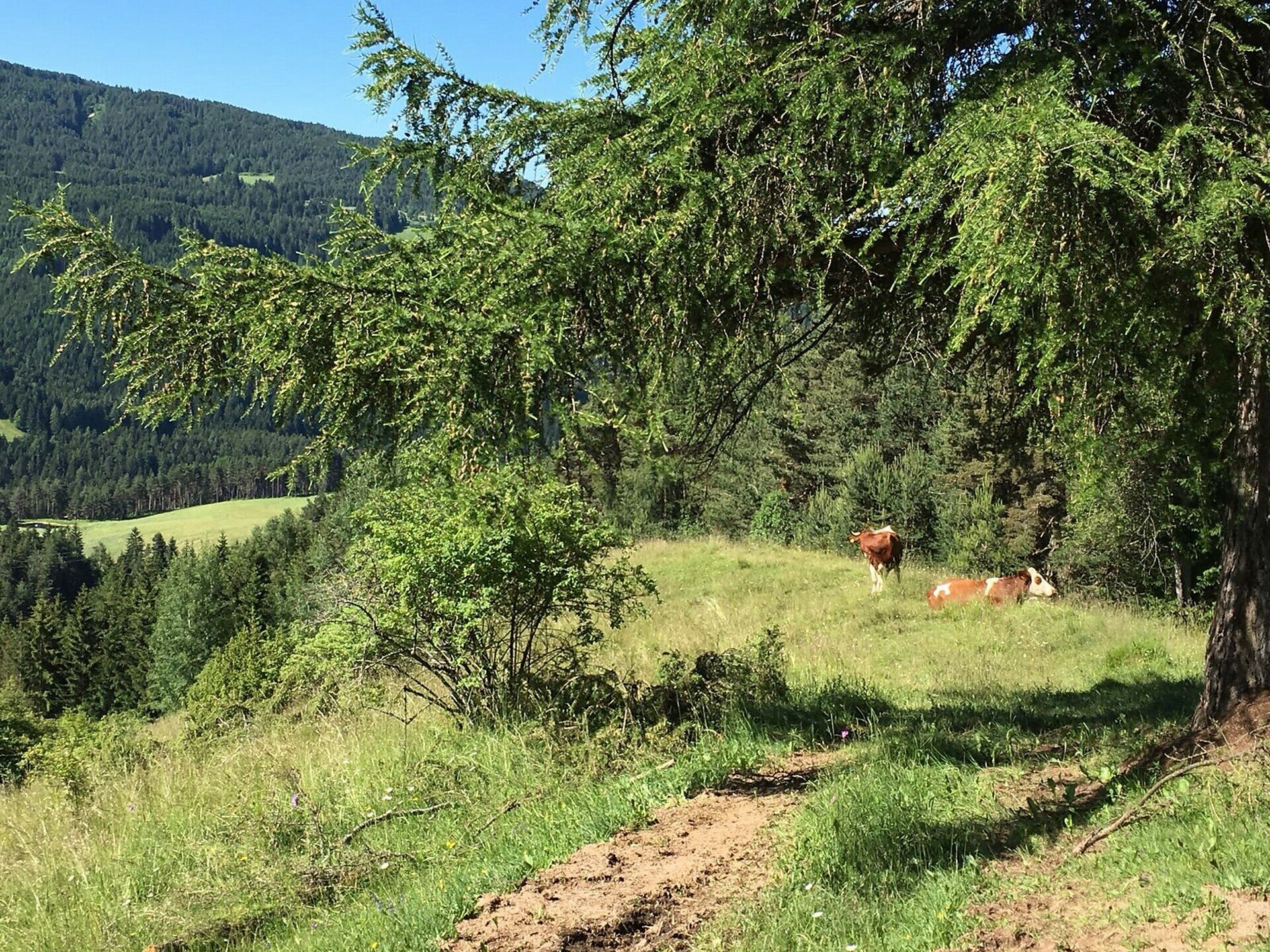
This hike is a wonderful way to experience the pristine natural beauty surrounding the village of Deutschnofen. Starting from the village center, the trail gently ascends through meadows and forests, passing quiet farmsteads and peaceful woodland.
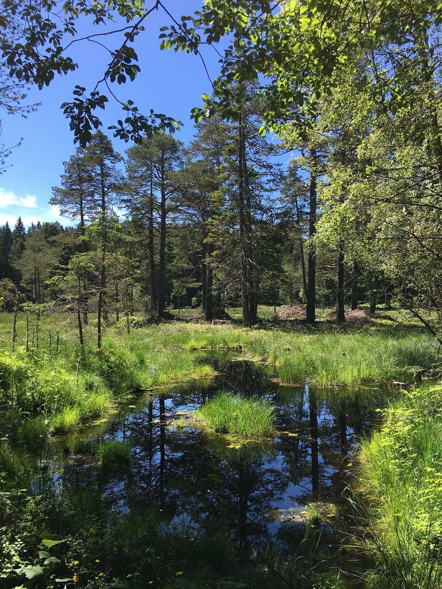
A true highlight is the “Totes Moos” biotope – a protected wetland area home to rare plants and wildlife. It’s a place of silence and serenity, where nature reveals its quiet power.
From there, the trail continues through dense forest paths until it opens up to breathtaking views. At Rotstein and Rotwand, hikers are rewarded with scenic vistas and dramatic color contrasts between red rock formations and lush greenery.
This tour is perfect for nature lovers, families with some hiking experience, and anyone seeking peaceful moments and stunning landscapes far from the crowds.

Route info
Intermediate
Distance
8,0 km
Activity time
2 h 30 min
Ascent
324 m
Descent
157 m
Physical effort
Scenary
Highest point
1.536 m
Lowest point
1.284 m
Directions

The hike begins in the village center of Deutschnofen. From there, follow trail [E5, 1] heading south through meadows and quiet roads to reach the Wölflhof.
Continue into the forest on trail [1], which leads to the protected “Totes Moos” biotope, a unique peatland with rare plants and animals.
At the biotope, turn right onto trail [1A]. After a gentle 20-minute climb, you’ll reach Rotstein, and after another kilometer, the scenic viewpoint Rotwand, with panoramic views to the south and west.
Return on the same route: [1A] → [1] → [E5, 1], back to the center of Deutschnofen.

public transportation

Getting to the starting point of the tour by public transport is easy and convenient.

By public bus line:
- 181 from Bozen | Bolzano,
- 180 or 184 from Karersee | Lago di Carezza, Karerpass | Passo Costalunga, Welschnofen | Nova Levante
- 184 or 181 from Birchabruck | Ponte Nova
- 184 from Stenk, Eggen | Ega, Obereggen
- 184 or 181 from Weissenstein | Pietralba, Petersberg | Monte San Pietro, Deutschnofen | Nova Ponente
- 182 from Steinegg | Collepietra, Gummer | San Valentino
- 180 from Val di Fassa

Bus stop: Deutschnofen | Nova Ponente, Kirche; online timetable search at www.suedtirolmobil.info/en/

How to get there

Getting to the starting point of the tour by public transport is easy and convenient.

By public bus line:
- 181 from Bozen | Bolzano,
- 180 or 184 from Karersee | Lago di Carezza, Karerpass | Passo Costalunga, Welschnofen | Nova Levante
- 184 or 181 from Birchabruck | Ponte Nova
- 184 from Stenk, Eggen | Ega, Obereggen
- 184 or 181 from Weissenstein | Pietralba, Petersberg | Monte San Pietro, Deutschnofen | Nova Ponente
- 182 from Steinegg | Collepietra, Gummer | San Valentino
- 180 from Val di Fassa

Bus stop: Deutschnofen | Nova Ponente, Kirche; online timetable search at www.suedtirolmobil.info/en/

By car:
Destination: Deutschnofen | Nova Ponente  
Parking: Parking lot Gibitz

Where to park
Parking: Parking lot Gibitz
You might be interested in
Discover related tours
Intermediate
Add to favourites
Steinegg
Circular hike on the Rittersteig trail from Steinegg|Collepietra to Wiedenhof
Distance 10,4 km
Activity time 3 h 45 min
Ascent 604 m
Descent 601 m
Karersee, Welschnofen
Family hike from the Nigerpass | Passo Nigra to the Messnerjoch hut
Distance 3,9 km
Activity time 1 h 16 min
Ascent 242 m
Descent 242 m
Welschnofen
Kaiserstein Tour
Distance 16,8 km
Activity time 1 h 45 min
Ascent 113 m
Descent 256 m
Status
closed
Intermediate
Add to favourites
Steinegg
Circular hike from Steinegg to the Hofschank Wiedenhof
Distance 9,7 km
Activity time 3 h 03 min
Ascent 525 m
Descent 521 m
Deutschnofen
Walking trail to St. Leonhard
Distance 1,8 km
Activity time 30 min
Ascent 60 m
Descent 60 m
Intermediate
Add to favourites
Deutschnofen, Welschnofen
Hike from Obereggen to Lake Carezza via the path "Templweg"
Distance 13,2 km
Activity time 3 h 30 min
Ascent 169 m
Descent 171 m
© Carezza Dolomites/Harald Wisthaler
Information & prices
Ski passes
Winter 2024/25

Here you will find all important information on skipasses, daily, multi-day, and seasonal tickets at a glance. All ski passes can be purchased quickly and conveniently online. Buy your skipass directly from home and get a 5% discount!

To the ski passes & tickets