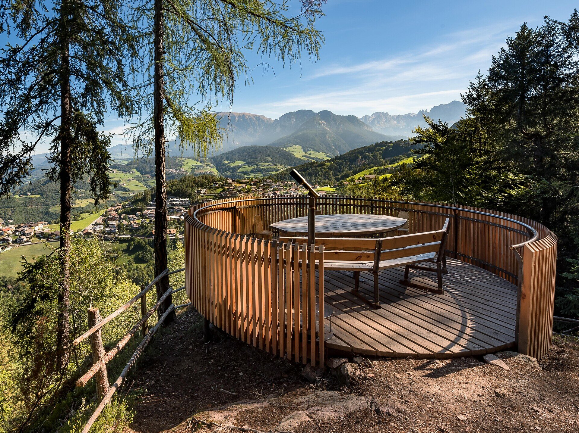
This circular hike from Steinegg|Collepietra combines nature, movement and breathtaking views. The first highlight is the Spitzköfele – a quiet lookout point offering a clear view of Steinegg|Collepietra, the Schlern|Sciliar and the Ritten|Renon high plateau. From there, the trail leads you to the heart of the tour: the Eggental Mountain Cinema – “Furner Oach”. Comfortable wooden chairs and a stylised cinema frame invite you to pause and take in the stunning panorama of the Rosengarten|Catinaccio, the Schlern|Sciliar, and – in the distance – the Zillertal Alps.
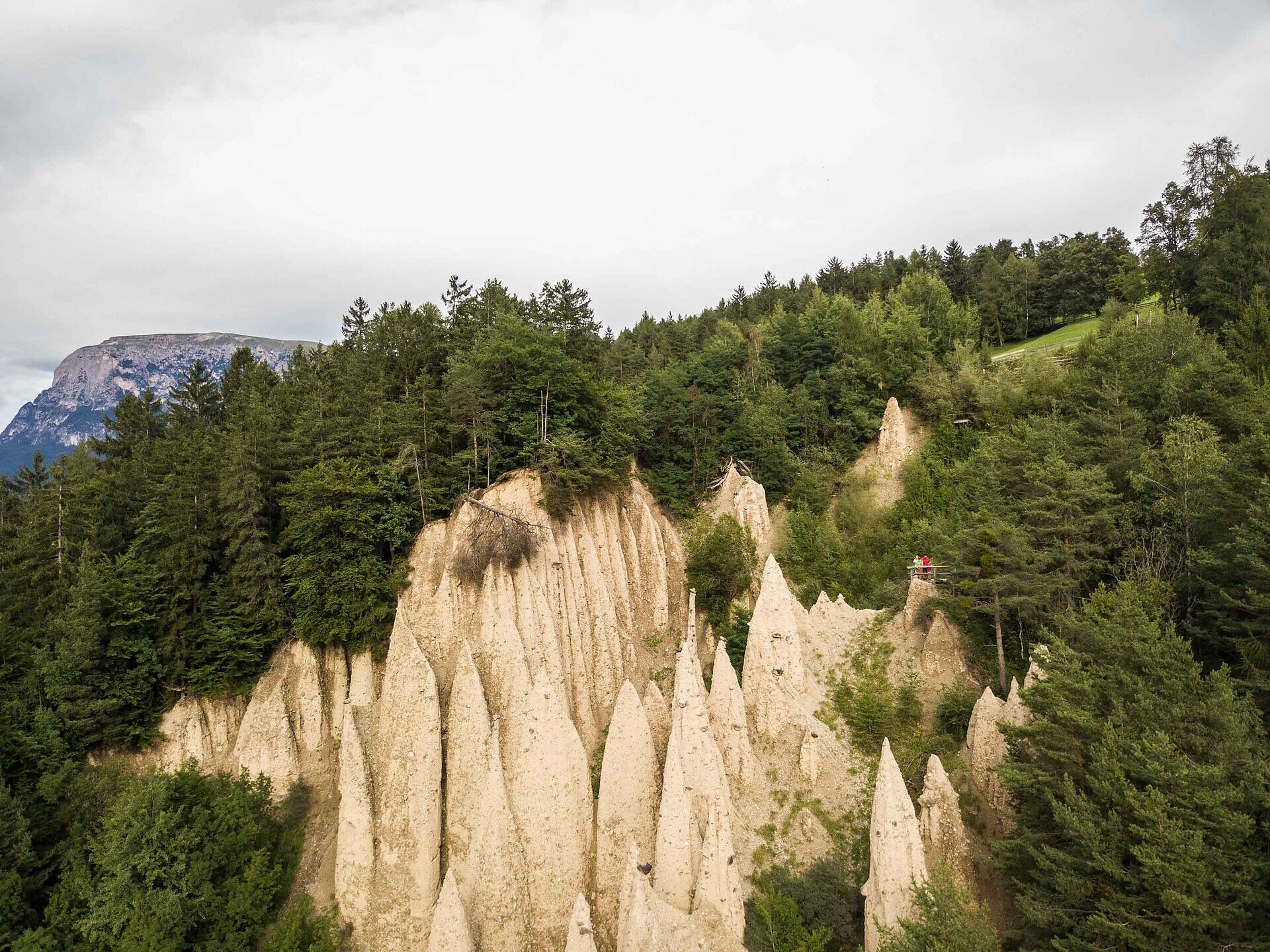
Toward the end of the route, the view opens up to a rare natural wonder: the earth pyramids of Steinegg|Collepietra, mysterious and fascinating. A hike that inspires wonder – step by step.
Important note: There are no refreshment stops along the entire circular route. However, at the start and end point in Steinegg|Collepietra, you will find several restaurants, cafés, and two shops.